


Lykins Voting District, Shawnee County, Kansas
About
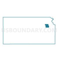
Outline

Summary
| Unique Area Identifier | 587340 |
| Name | Lykins Voting District |
| County | Shawnee County |
| State | Kansas |
| Area (square miles) | 0.00 |
| Land Area (square miles) | 0.00 |
| Water Area (square miles) | 0.00 |
| % of Land Area | 100.00 |
| % of Water Area | 0.00 |
| Latitude of the Internal Point | 39.02867510 |
| Longtitude of the Internal Point | -95.77497040 |
Maps


Graphs
Select a template below for downloading or customizing gragh for Lykins Voting District, Shawnee County, Kansas


Neighbors
Neighoring Voting District (by Name) Neighboring Voting District on the Map
- North Mission Voting District, Shawnee County, KS
- Topeka Ward 12 Precinct 15, Shawnee County, KS
- Topeka Ward 12 Precinct 31, Shawnee County, KS
- Topeka Ward 13 Precinct 05, Shawnee County, KS